By default, QGIS asks you which coordinate system to use when a layer that you add does not have a coordinate system mentioned in its metadata. Unfortunately, this is quite often the case, and can become quite annoying. Chances are that you are using the same coordinate system most of the time, probably the projected system of the country you live in.
You can easily tell QGIS to use this system as default coordinate system for new projects and for layers without assigned coordinate system. This is done via Settings – Options. Select CRS and then pick a default CRS for new projects, and set the default CRS for layers to the project CRS:
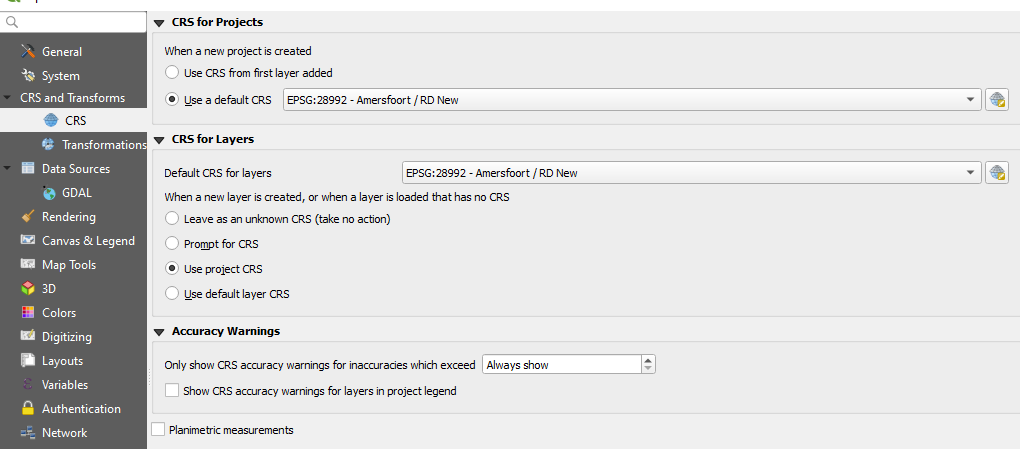
This rids you of many unnecessary prompts for unknown CRS. You will only need to manually set the CRS for layers in a different coordinate system.